3D View of Urban Radar Targets
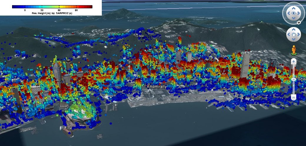
80 TerraSAR-X images have been processed to detect targets in the city of Hong Kong. Sarproz can export results in different formats and geocode both images and point clouds. Examples here are visualized in Google Earth.
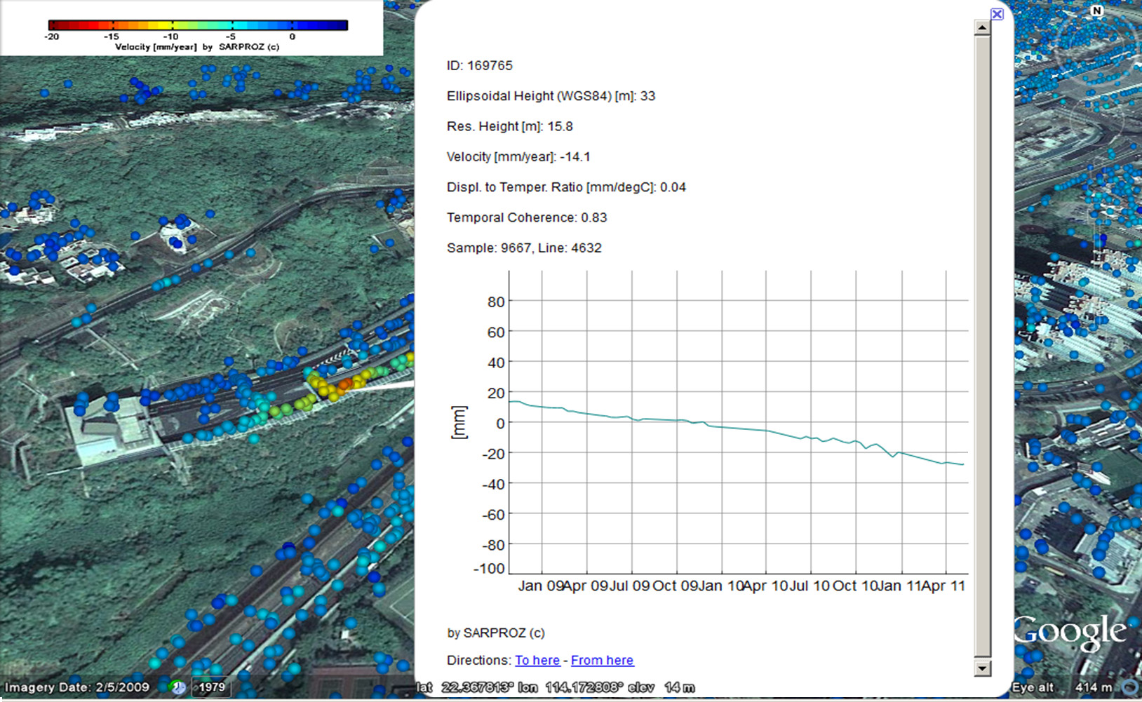
Example of time series of a detected target showing a progressive displacement.
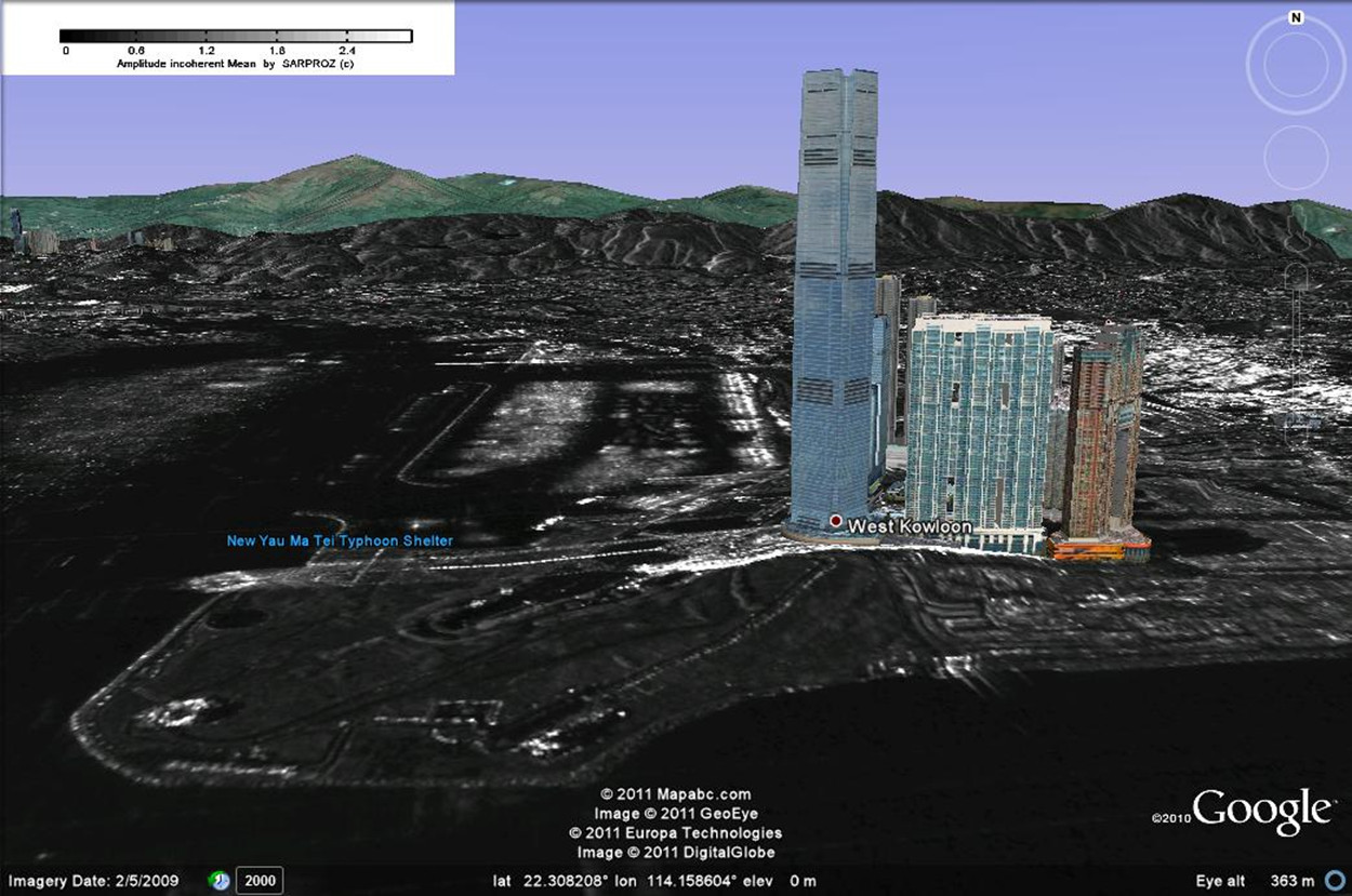
Reflectivity map geocoded in Google Earth together with 3D buildings.
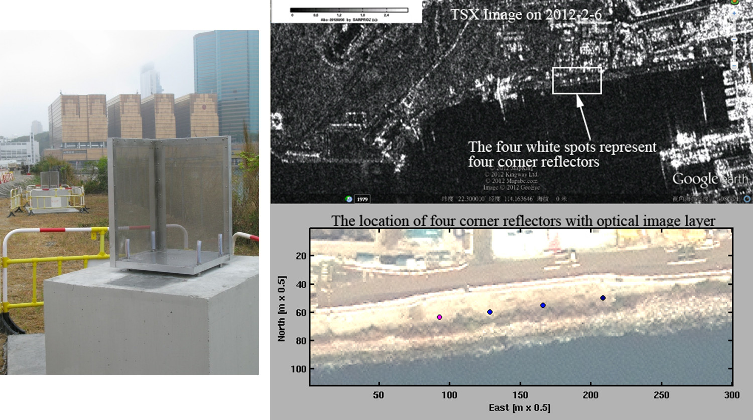
Corner Reflectors installed in Hong Kong for demonstration and validation purposes.
-
![[PDF]](https://www.sarproz.com/wp-content/plugins/papercite/img/pdf.png)
![[DOI]](https://www.sarproz.com/wp-content/plugins/papercite/img/external.png) Y. Qin, D. Perissin, and L. Lei, “Design and Experiments of Corner Reflectors for Urban Ground Deformation Monitoring in Hong Kong,” International Journal of Antennas and Propagation, 2013.
Y. Qin, D. Perissin, and L. Lei, “Design and Experiments of Corner Reflectors for Urban Ground Deformation Monitoring in Hong Kong,” International Journal of Antennas and Propagation, 2013.
[Bibtex]@Article{qin-daeocrfugdmihk2013, Title = {Design and Experiments of Corner Reflectors for Urban Ground Deformation Monitoring in Hong Kong}, Author = {Qin, Y. and Perissin, D. and Lei, L.}, Journal = {International Journal of Antennas and Propagation}, Year = {2013}, Doi = {doi:10.1155/2013/191685}, Owner = {periz}, Timestamp = {2015.02.08} } - Y. Qin, D. Perissin, and L. Lei, “An Evaluation of the Performance in Ground Settlement Monitoring in Hong Kong Using Satellite Radar Remote Sensing Technology,” in Proc. of ISRSE 2013, Beijing, 2013.
[Bibtex]@InProceedings{qin-aeotpigsmihkusrrst2013, Title = {An Evaluation of the Performance in Ground Settlement Monitoring in Hong Kong Using Satellite Radar Remote Sensing Technology}, Author = {Qin, Y. and Perissin, D. and Lei, L.}, Booktitle = {Proc. of ISRSE 2013, Beijing}, Year = {2013}, Owner = {periz}, Timestamp = {2015.02.08} }